You cannot select more than 25 topics
Topics must start with a letter or number, can include dashes ('-') and can be up to 35 characters long.
|
|
8 years ago | |
|---|---|---|
| doc | 8 years ago | |
| dxf_to_csv | 8 years ago | |
| README.md | 8 years ago | |
| setup.py | 8 years ago | |
README.md
dxf-to-csv
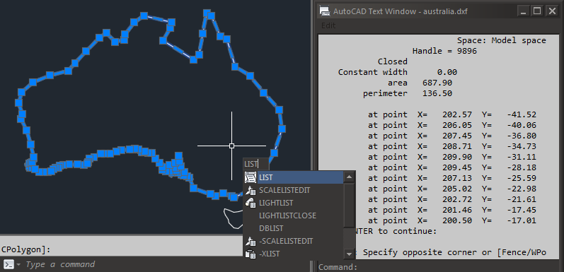
dxf-to-csv is a tool to extract coordinates from CAD drawings.
AutoCAD offers the LIST command, which shows the geometry of selected objects, but this approach is not practical when dealing with a large number of objects.
Installation
pip install dxfgrabber
Then
git clone http://git.wrl.unsw.edu.au:3000/gis-cad/dxf-to-csv.git
cd dxf-to-csv
python setup.py install
Usage
Show available layers:
dxf_to_csv drawing.dxf -l
Convert all layers:
dxf_to_csv drawing.dxf
Convert specific layer:
dxf_to_csv drawing.dxf -n LAYER_NAME
Output
drawing.csv
| layer | type | id | x | y | z |
|---|---|---|---|---|---|
| MAP | LWPOLYLINE | 9896 | 202.568 | -41.517 | 0 |
| MAP | LWPOLYLINE | 9896 | 206.053 | -40.062 | 0 |
| MAP | LWPOLYLINE | 9896 | 207.450 | -36.796 | 0 |